Trail E – Plitvice Lakes National Park
Route E details:
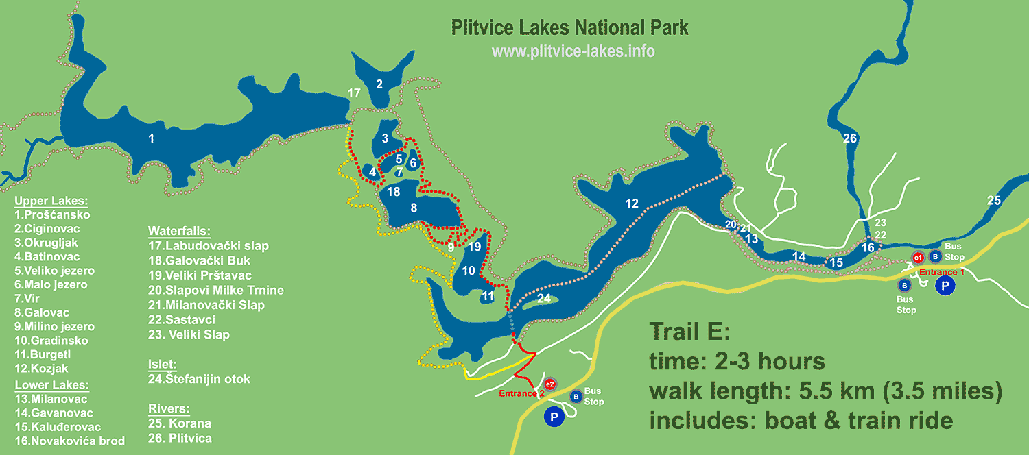
- time to complete a walk: 2-3 hours
- length: 5.5 km (3.4 miles) walk
- includes: short boat and panoramic bus ride
- lakes: Upper Lakes (Gornja jezera)
- type: a circular walk
- mode: walking= red dots; train/bus = yellow dots and lines; boat= blue dots (see below map)
Map of Trail / Route E – Plitvice National Park:
Above map: click to see the large map
This is a fairly short walking route in the higher area of the Park and a popular among visitors who perhaps already visited Lower lakes. The walk includes boat and train/bus ride (yellow and blue dots and lines on above map).
Starting from the Entrance 2 (the southern one), the walk covers waterfalls and lakes of Upper part of the Park. The route is equivalent to trail B but in Upper lakes instead.
After a short boat where you cross Kozjak lake, the footpath is extending to the higher elevations, along Burgeti, Gradinsko, Milino, Galovac and Okrugljak all the way to the edge of Proscansko lake.
The walking route is very enjoyable, easy to follow, featuring beautiful Veliki and Mali Prstavac and Galovacki Buk waterfalls.
Once you reach Proscansko lake, the furthermost one in the Park, take a panoramic train/bus back to the Entrance 2. The train ride is slow and peaceful (electric motor) with plenty of opportunities to take photos and/or videos.
Popular Routes: Zagreb to Plitvice, Zadar to Plitvice, Split to Plitvice
Very enjoyable way to spend several hours in the Upper Lakes.
Note: This route is often closed in the winter time due to heavy snowfalls. You can still walk around any time you wish just boat or train service is not in the operation in snowy periods so you have to walk the whole route.
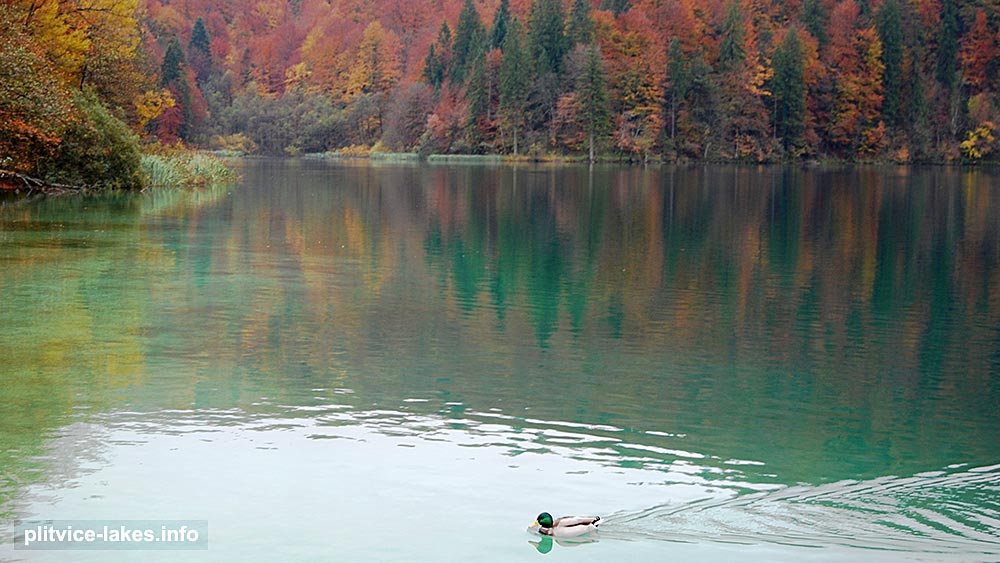
Above photo: detail of the walk, views over the lake with a wild duck swimming in the foreground

