Maps of Plitvice Lakes
Collection of Plitvice Lakes (Plitvička Jezera) Maps:
Here you can find a wide range of maps covering the whole of the Plitvicka Jezera National Park. There are different maps of Plitvice lakes to suit walking, driving, or for local amenities.
Some of these maps are available at tourist information centres across the area. Some of the maps that I collected here are historical, dating back to the beginning of 20th century.
Click to see updated interactive map here; See also walking routes/trail maps: Trail A; Trai B; Trail C; Trail E
")
Map of Plitvice Lakes National Park with locations of lakes, waterfalls and other important places (updated) – click to enlarge
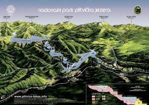
Visitor Map (3D) of Plitvice Lakes National Park (2009)
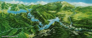
Panorama of Plitvice Lakes National Park
Popular Routes: Zagreb to Plitvice, Zadar to Plitvice, Split to Plitvice
")
Map of Plitvice Lakes National Park (2009)
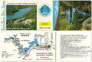
Map and entry ticket to Plitvice Lakes (the 1970s) – French
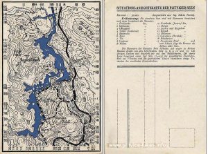
Plitvicka Jezera Map (the 1940s)
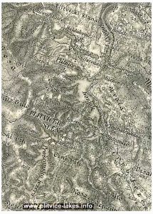
Map of Plitvice Lakes from the 1920s
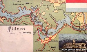
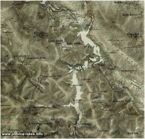
Map of Plitvice Lakes from the 1880s
Map of Plitvice Lakes from 1865
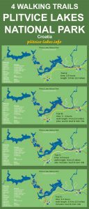
Map of Four Walking Trails in Plitvice Lakes